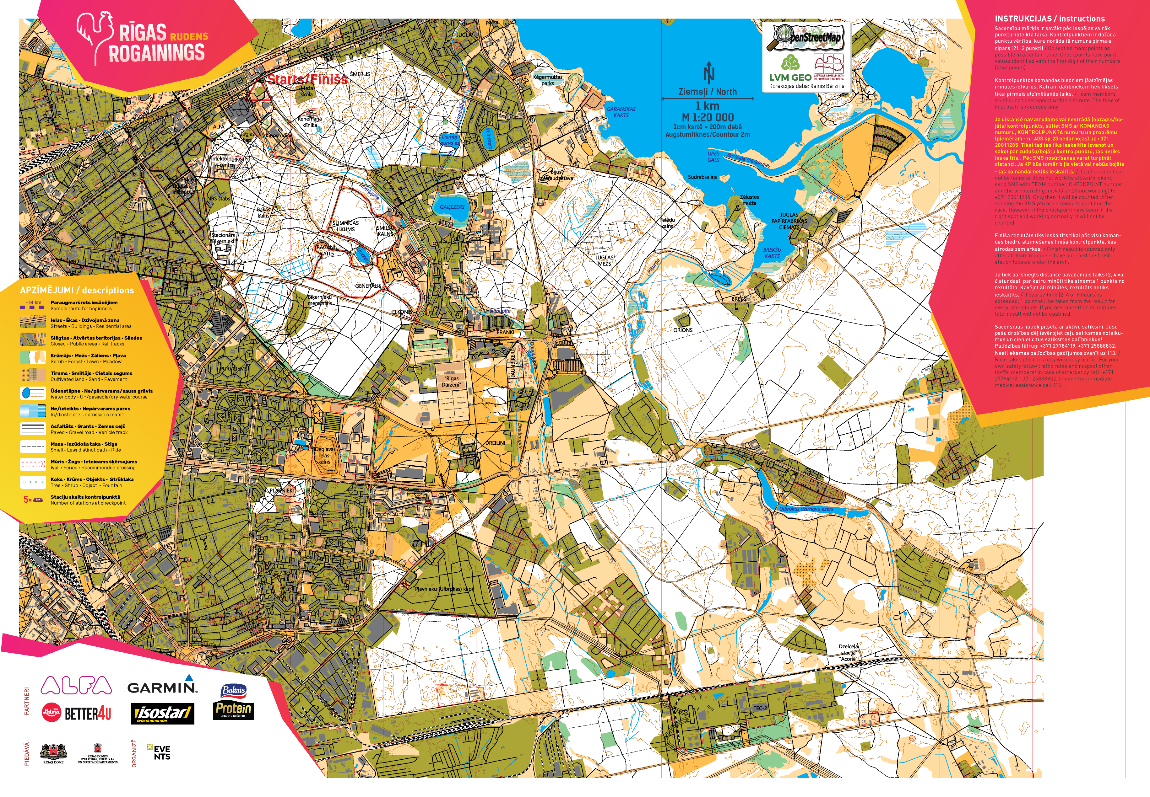
Riga Autumn Rogaining map published without checkpoints

Well, you can start calibrating your gauges and curve meters, because the Riga autumn rogaining map has just been published. We will bring the checkpoints to the table only on the day of the competition (in less than two weeks), so that a caterer does not read them before the big rogaining festival.
Original publication date: 29.10.2019
Those who have already participated in Riga Rogaining at least once, will not be able to change anything in their planning, because the current scale will remain 1:20'000 or 1 cm = 200 m. Standard orientation designations will be used (open space - yellow, forest - white, thick brush - green).
The basis of the map is OpenStreetMap, which you probably already use on a daily basis in a smartphone application, and in which not only we, but hundreds of cartography enthusiasts participated in polishing.The relief was provided by the Geospatial Information Agency of Latvia, flying over Riga with a plane and shooting every small hole with a laser cannon. But these obtained laser points were interpreted by the Latvian State Forests. If you see 2 brown contour lines next to each other on the map, one will be 2 meters higher than the other in nature. Where there are the most brown lines on the map - look for Riga's highest (artificial) peak!
We tried to distinguish insurmountable (surrounded by a dark border), surmountable (without a border) and dry (brown dotted) ditches, without wading into them all ourselves and without measuring whether the water would flow into the mouth. We considered those who seemed to be able to jump or wade no deeper than the waist to be overcome. However, it will be possible to reach all checkpoints on dry feet unless you choose the most direct route.
Places where it is recommended to cross various insurmountable obstacles (fences and streets with heavy traffic) are circled in red. You can count how many tunnels it is possible to cross the Biķernieki highway.
Private areas (factories, educational institutions, small gardens) are colored olive green. Wherever we explored, we also marked fences, which shows that you will not be welcome there at all. Elsewhere, we marked the roads through which these territories can be safely passed through. But it is safest to make a detour to such olive-green areas - if there is no fence on which to tear your pants, a dog who, like you, is looking forward to November 9th will gladly do it. We can't guarantee that you won't come across a "Nepiederošiem ieeja aizliegta" sign outside the olive green areas either. Consider that it is impossible to fully survey such a wide area and you may come across some changes not marked on the map. But there is already that rogaining salt - always be ready for surprises.